
I know its quite late to jot down this blog because I did this (Bali Pass Trek) trek back in 2016 when I used to be an amateur trekker. This was my 3rd trek and one of the toughest till now. The experience was so amazing that I could still relive the moments from the trek and that is why I am writing this blog.
About Bali Pass Trek
Bali Pass is a high altitude mountain pass which links Har Ki Dun valley to Yamunotri valley. Situated at a height of 4950 meters, it offers one of the best views of Swargarohini and Banderpuch massifs.
Preparation before the trek-
I was very excited to do this trek as this was my first challenging trek and the altitude was also pretty high around 16,200 feet. Despite giving a much worse performance on the previous two treks (Nag Tibba & Triund), I still nodded yes to do this trek just because of excitement. I was quite sceptical about my decision of joining the trek but I tried not to get distracted and maintained my confidence level by concentrating on the trek.
After the confirmation of my trek, I searched a lot about it, read several blogs, checked out photos and tried as much as possible to educate myself about the trek.
And finally, the day arrived on which I had to pack my things and leave for the trek. I was super excited and all set to leave Delhi and enter the mountains. Boarded the overnight bus from Delhi to Dehradun.
Day 1: Dehradun to Sankri – Drive
I arrived at Dehradun ISBT in the morning by 6 am. The meeting time was 7 am so I had one hour to kill. I got freshened up and had piping hot tea. Then, Rahul (trek leader) called me and finally, I met my trek mates. There were a total of 6 members excluding me and I was the youngest in all of them.
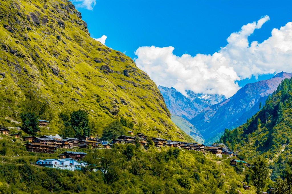
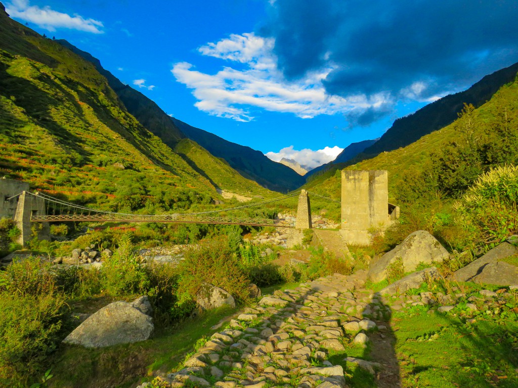
After all this, we began our mountain drive towards Sankri in Uttarkashi district. Sankri is a famous village as it is a starting point of several popular treks such as Har ki Dun, Kedarkantha, Ruinsara Tal, Maninda Tal, Borasu Pass and of course Bali Pass. Well, locals claim that there are approximately 50 treks that one can do in this region. Only a few are explored as of now. There are several hotels, guest houses and shops available from where one can buy daily need stuff and trekking gear. ATM’s are also available there.
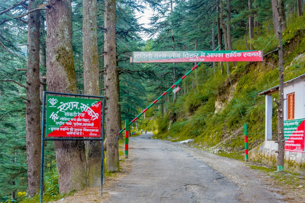
We drove through Mussoorie, had our breakfast at a restaurant near Kempty falls and then continued our drive through Nainbagh, Naugaon, Purola, Mori and Netwar. The vehicle was bolero and I was seated on the back seat due to which I started feeling Nausea. So I tried to sleep during the drive but couldn’t because the road was full of curves and sharp bends. The route turned scenic as we crossed Purola. We were driving through the pine forest along the Tons river, which is formed by the confluence of two rivers named Rupin & Supin. From the confluence, we took the road which goes along the Supin river and then crossed the Netwar forest check post (on which a lady ghost used to live, as said by locals) and finally entered the region of Govind Wildlife Sanctuary.
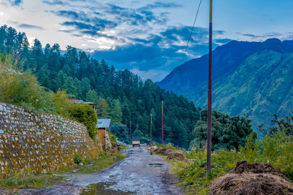
We reached Sankri village by evening and relaxed for some time in the hotel, as everyone was tired after a long journey. Later, we had dinner and did a short night walk. I love doing night walks on mountains as the atmosphere remains peaceful and the sky remains dotted with stars.
Day 2: Drive to Taluka and Trek to Seema
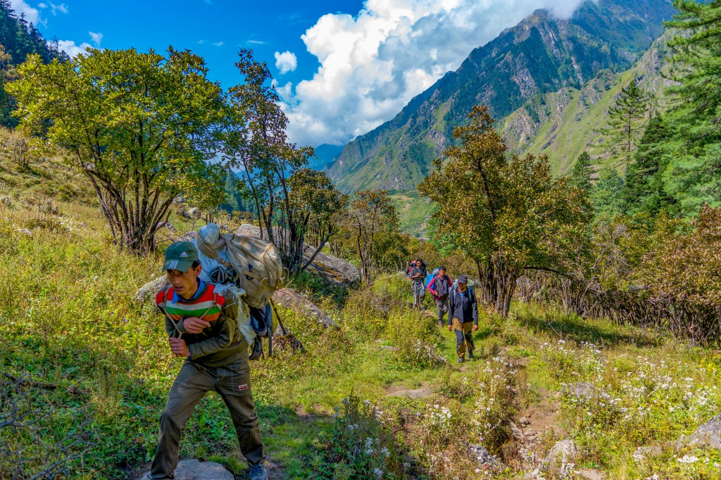
We all got ready by 8 am and then left for Taluka village, which is 12 km from Sankri and is the last road head. The vehicle was Bolero camper and we were accompanied by 8 porters who were supposed to carry the trek logistics such as tents, sleeping bags, ration, utensils and other equipment.
In India, there are two types of treks, one on which porter carries the stuff/logistics and another one on which mule/horse carries the stuff/logistics. The former one is used especially on challenging high altitude treks where the route is not paved and good enough, so mules cannot go there, whereas the latter one is used on all other treks where there is a proper route and are not very difficult.
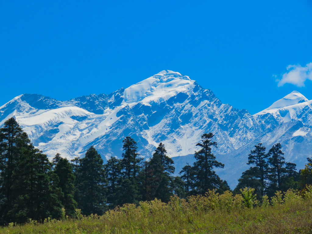
Coming back to the trek. As there was no space in the vehicle, some porters climbed and sat on the roof. Despite having one seat inside the taxi, I also settled on the roof as I always wanted to do it. I had great fun in that short journey. We also had our first glimpse of Mt. Swargarohini (Gateway to Heaven) massif while travelling towards Taluka village.
Legends about Swargarohini: Read Here
Now it was the time to start our trek. Our trek leader (Rahul) briefed about the route and other things and then we began by chanting Har Har Mahadev.
We entered the forest and took the muddy trail which was going towards Gangaar and Seema villages. It was a bright and sunny day and we were enjoying the initial trek as it was easy. We met several trekkers on the way. Some were going towards Seema while some were returning. Initially, I thought that they are also going to Bali Pass but later I came to know that our group was the only one going to Bali Pass when the local guide told me.
The trail wasn’t marked but the route was easily identifiable. In a conversation with one of the trek mates, while trekking, he told me that the best way to find the correct route on a trek is by noticing the mules/horse shit on the trail. :p
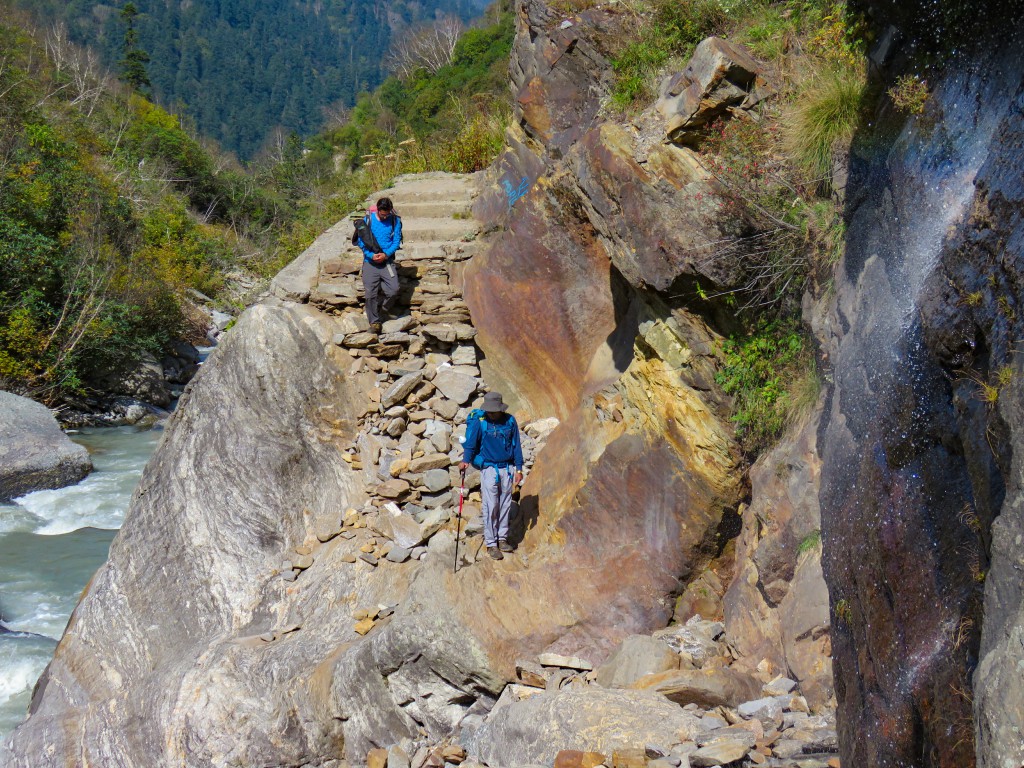
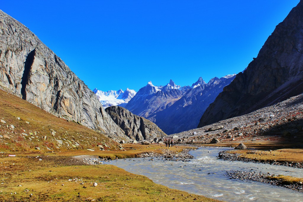
The overall trail was a mixture of uphill and downhill routes and mostly through the forest. We crossed a couple of bridges and all the time we were walking along the Supin river which made the trek more interesting.
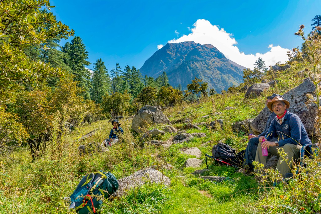
We reached Seema village by evening 4 pm after covering a distance of around 15 km. The view from the village was beautiful. After relaxing for some time, I explored the village and the nearby bridge. Later, we had our dinner and slept.
Day 3: Seema Camp to Rainbasera – Trek
In the morning, we had a refreshing yoga session. Trust me, mountains are the best place to practice yoga. Now, its time to get away from the crowd and take the lesser-known trail. We started the trek by 8 am after having breakfast of aloo parathas and took the trail straight from the village and entered the forest having dense bushes. Initially, the trail was a blend of uphill and downhill. There were a few tricky patches where we had to cross boulders and small waterfalls.
In around 3 hours, we reached a small meadow named Debshu Bugyal. The meadow was tiny but beautiful. The green dense bushes having butterfly meandering through them and the views of snowcapped Black peak made that place a perfect spot to relax. I got completely awestruck as it was the first time I was seeing any snowcapped peak so closely. We had our lunch there and then resumed the trek. The second half of the trek was mostly downhill. Now the best thing was that there was no one on the trek except us. The sceneries also got changed and the valley transformed from narrow to a huge one having big mountains encircling us. The views were also getting better and better with every single step we were taking.
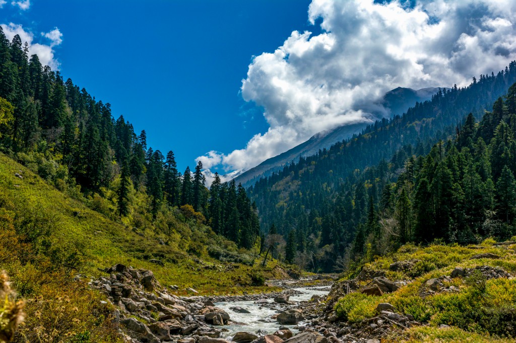
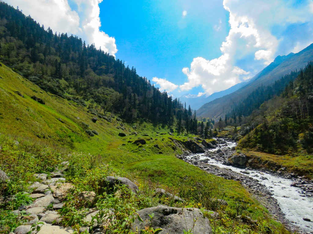
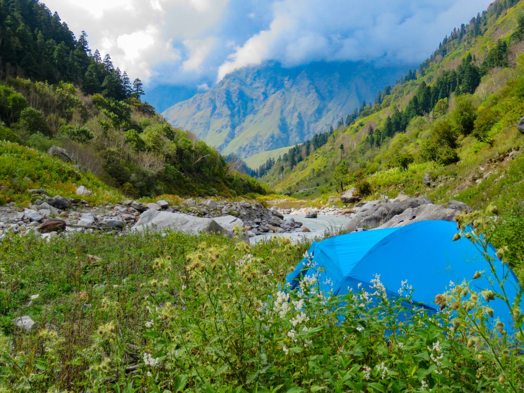
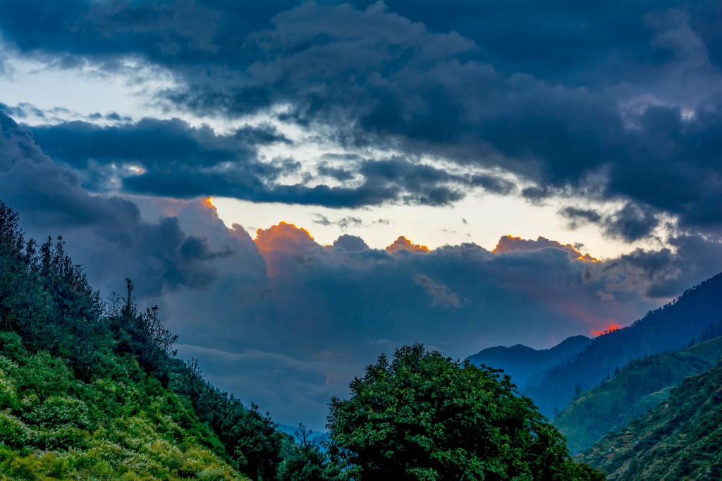
After descending completely, we almost reached the river bed. While we were resting and assuming about our campsite location, the local guide and the staff started pitching camps there and then we got to know that this was our campsite. The place was amazingly beautiful and it was certainly the best campsite on that trek. The camps were pitched on the grass having bushes. The black peak was also visible from our campsite and we could clearly hear the sound of Supin River all the time. In the evening, I did a small meditation session for a few minutes near the river and honestly, that was the best part of that day. Had a small bonfire session followed by dinner and then we slept.
Bali Pass Trek Blog – Part 2 – Read Here
Bali Pass Trek Blog – Part 3 – Read Here
[…] & Triund was my second trek. After that, I moved on to do the difficult treks like Hampta Pass, Bali Pass, etc and in the meantime, I never thought of exploring Kasol. But I’d heard a lot about […]
[…] Also Read: Bali Pass Trek Blog – An Offbeat Himalayan Himalayan Trek […]
[…] that job due to some reasons. However, those 3 months were good during which I also went for the Bali Pass trek (sponsored by the company) and that trek made me mad about […]