Haven’t read the part 1 of Deoariatal Chandrashila Trek: Read Here
Day 2:
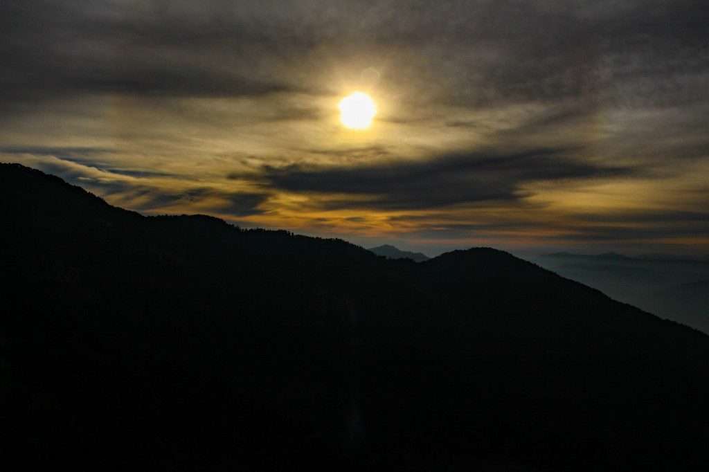
The alarm rang and we woke up at 5. We quickly got ready with our camera and started waiting for the first light. The guide was right about the sky as it was clear and Chaukhamba was visible. We waited for the day to b and then the mighty Chaukhamba featured in front of us. It was really an amazing feeling to see such a breathtaking view. We took several shots from different places and different angles almost filled the half memory card. After satisfying the hunger of our camera, now it was the time to kill our stomach hunger. We had our breakfast and then got ready for the main movie, the 14 km long trek to Chopta.
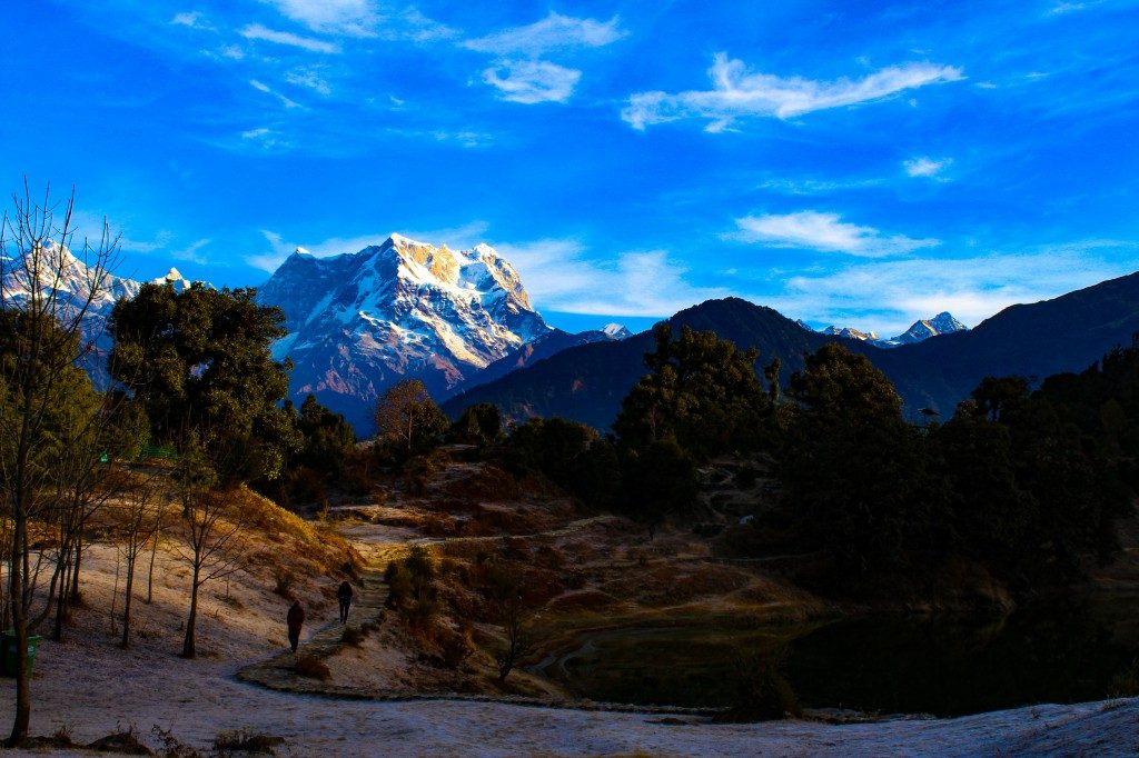
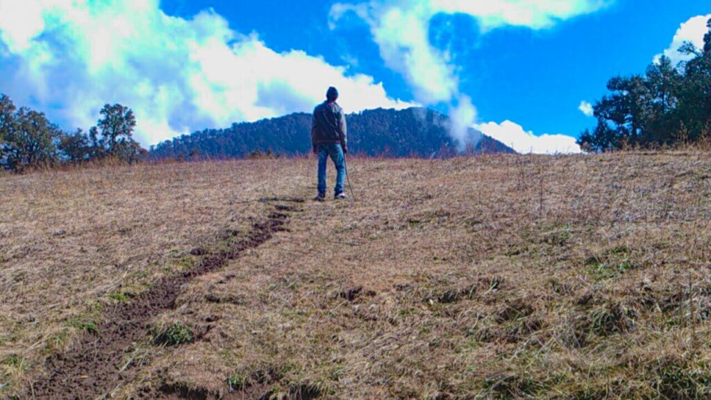
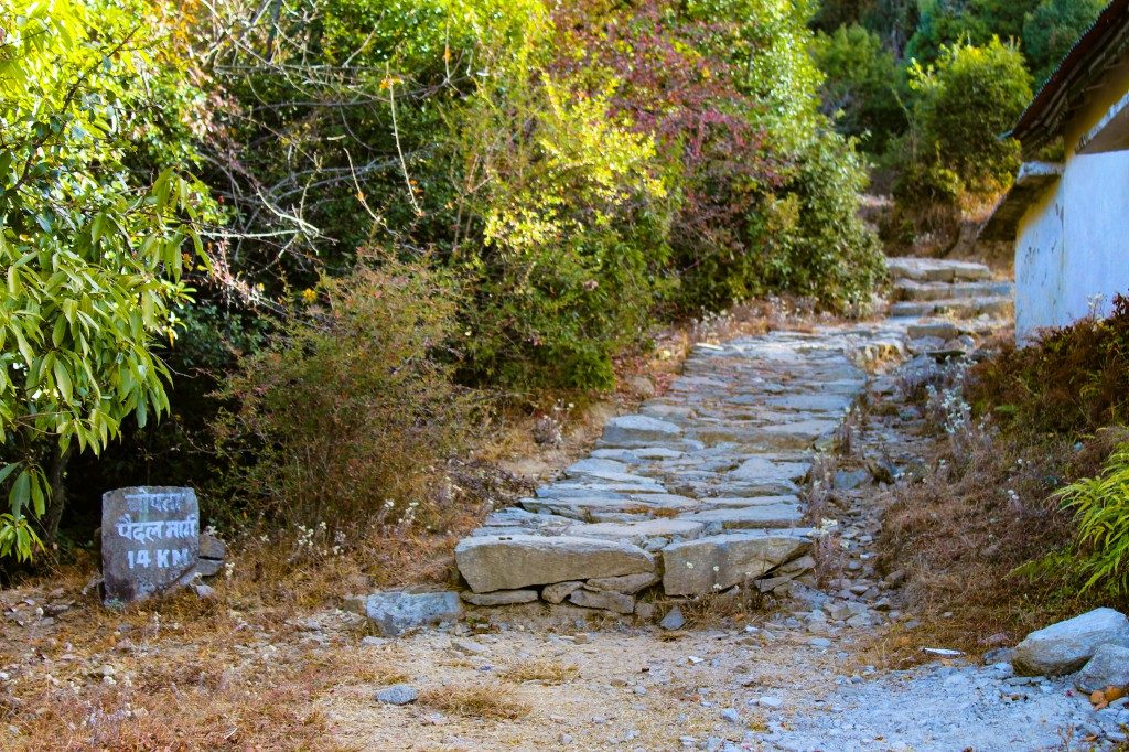
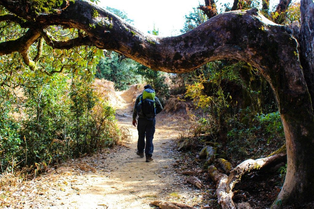
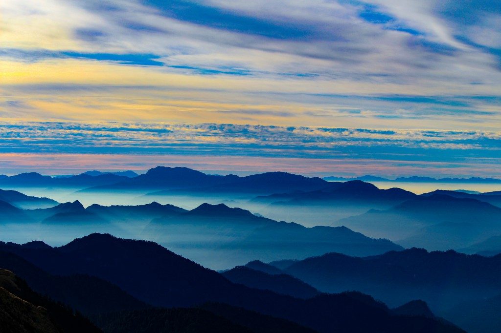
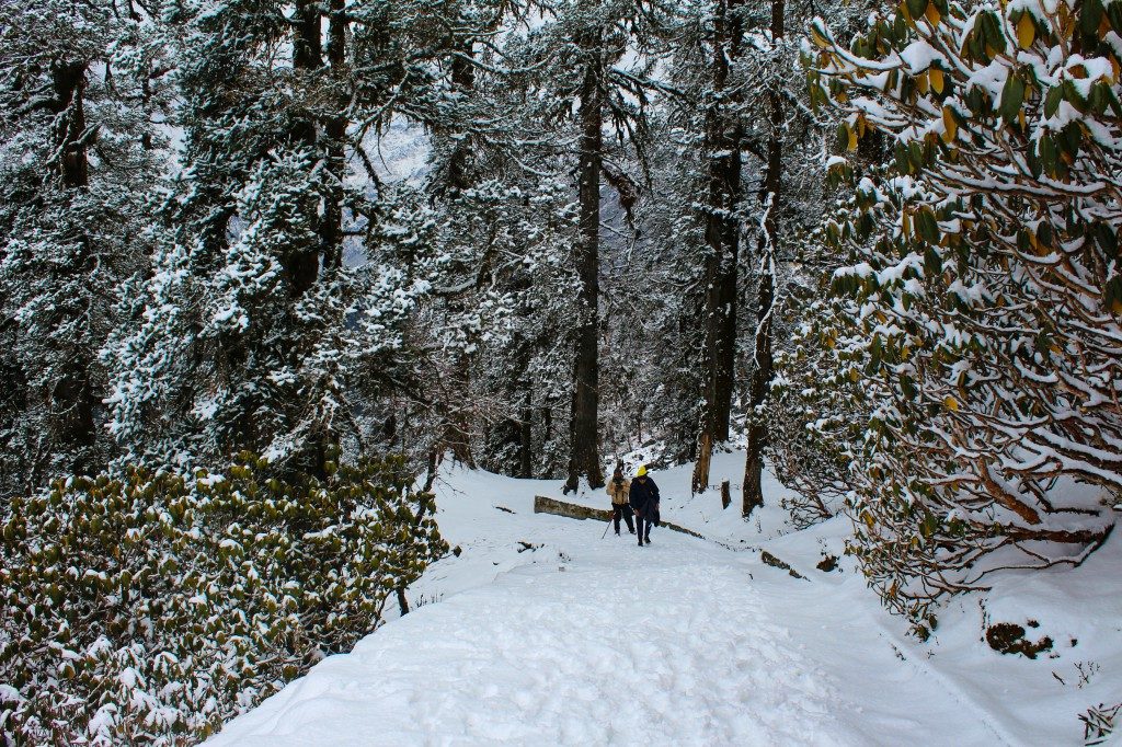
We began at 8:30 and started walking towards the watchtower. Clicked some more photos from the tower as it was offering the 360-degree view of surroundings and continued. We walked for few meters and then found a milestone showing distance of Chopta which was 14 km and from that point we entered the forest. Initially the trail was easily visible and it continued up to a point from where we could get a view of the Sari village. Here we completed our first kilometre and now we had to trek through a mountain ridge and reach the top. This was the first steep stretch of today’s trek. We began walking on this stretch and reached the top in half an hour, which was called Jhandi Dhar or Jhandi Top. The view from the top was breathtaking. We could get a bird’s eye view of the Sari village. On the right side, there was Sari village in the valley and Chaukhamba massif on the left.
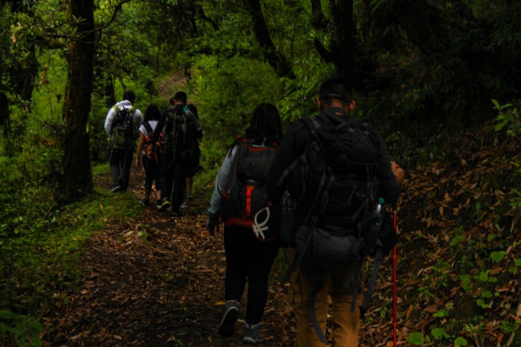
After spending some time there, we started moving and again entered the forest. The further trail was descent and slippery due to wet mud at few stretches. We continued the walk for next five km, crossed the second steep stretch and then reached a big meadow. The guide told us that it was Rohini Bugyal. The site was pretty much scenic. We decided to have our packed lunch there. While having lunch, we also spotted two jackals there. When I stood up to capture them they ran away :/ After having lunch, we resumed our walk through the forest and reached a point from where we had to take a left turn. There was also a signboard showing the distance of Chopta and it was 4 km.
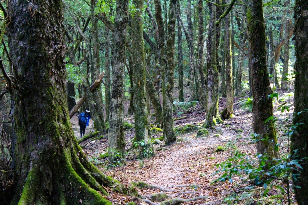
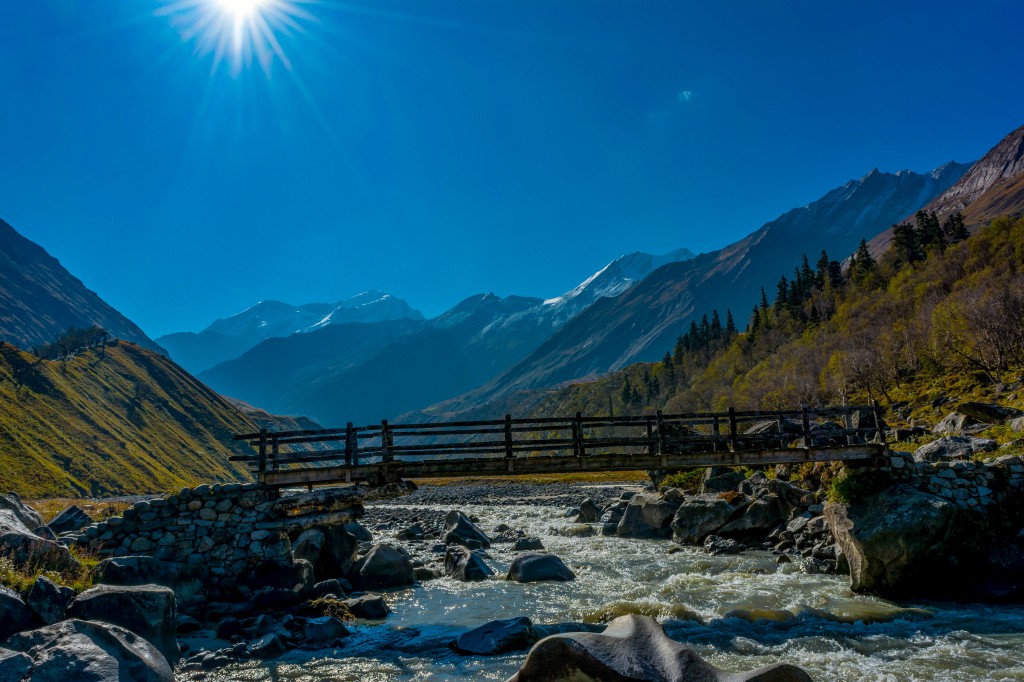
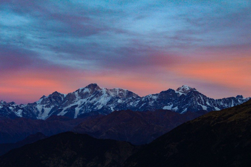
Now Chopta was 4 km away from us. We took the left turn and followed the trail. The trail was a mixed of ascent and descent, which continued up to one km and then a sharp descent started. The descent leads us to the waterfall. We took a halt there and refreshen us up with the cold and fresh water. The further trail was continuous ascent up to the roadhead of Chopta. Without any further delay, we covered that distance and reached the road head by 4:30 PM. The guide already told us that the sunset from Chopta looks beautiful. So we waited on the road for the dusk and yes the guide was correct. It was mesmerising. The sky took the shade of orange and the surroundings were so calm.
We then walked towards our campsite and had tea and refreshments. Later we had dinner and slept early because we had to start at 3 AM for the climax, Chandrashila summit. The night was already cold but the sleeping bags were quite warm and we managed to sleep.
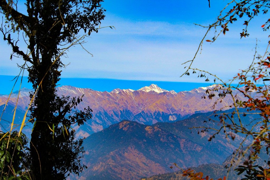
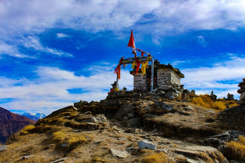
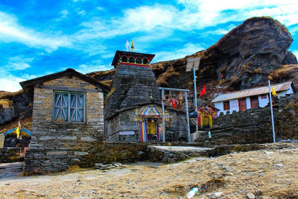
Day 3: We woke up, got ready and departed for the trek. The weather was chilling cold at that time. Today’s trek was 10 km long but it was continuously uphill and steep. The only good thing with the trail was that it was paved but the last 1.5 km was not. We were told that the sunrise from the peak looks beautiful so we were trying to keep our pace good. It was also helping in keeping our body warm. The trail was a straight uphill and after 500 meters, the forest ended and meadows of Tungnath started. The Chaukhamba massif was started getting visible. We reached the Tungnath temple and we were left with less time for the sunrise. So we continued the trek up to Chandrashila peak. The sky was turning pink and sunrise was about to happen. After passing the temple, we were hit by freezing winds. Our hands got numbed but still, we continued the trek. It took us another 40 minutes to reach the summit. We missed the sunset but got the view of Chandrashila peak when the first sunlight fell on it.
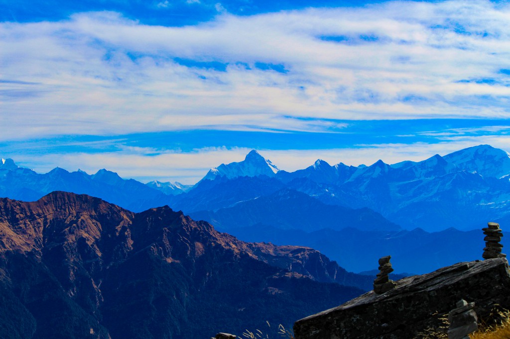
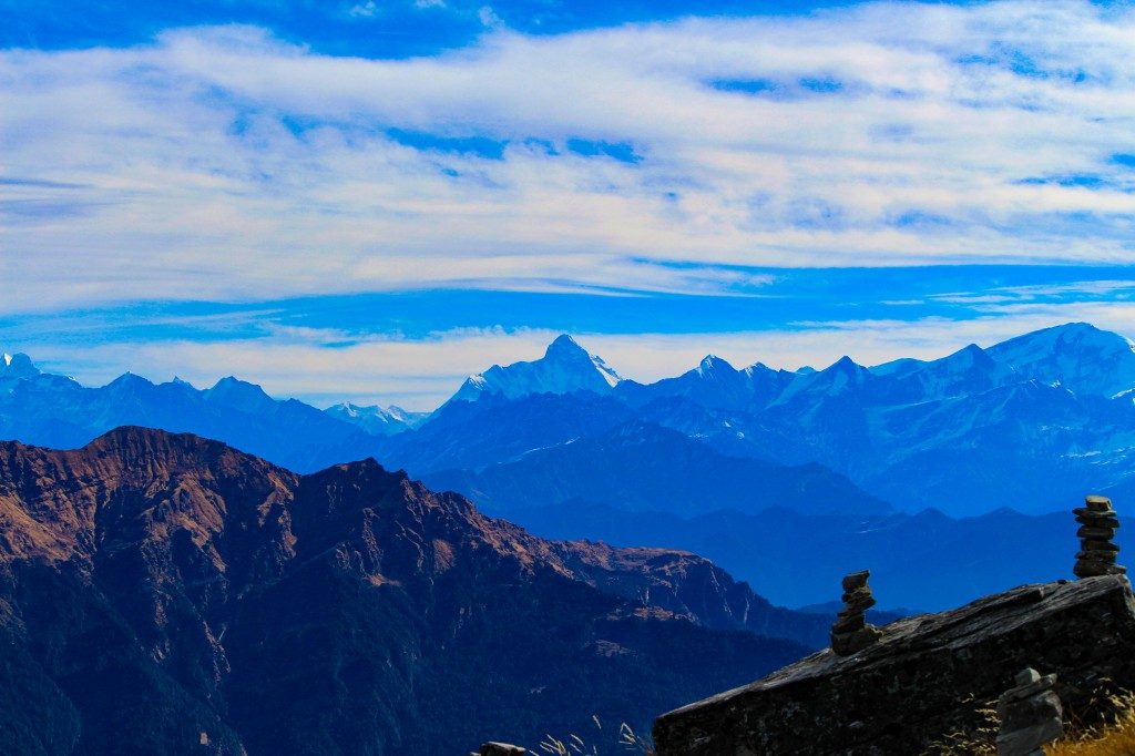
The view from the top was spectacular. From left to right, we could see almost all the remarkable peaks of Uttarakhand including Chaukhamba, Kedarnath, Mandani, Janhukut, Nanda Devi, Nanda Ghunti, Trisul, etc. We captured each and every peak, made cairns and had photoshoots there. After half an hour, we started descending from the summit. While coming down, we also explored the temple. The descent was easy as always. It took us less than 2 hours and we were at Chopta. We had aloo paranthas and omelette at a restaurant and then began our drive back to Delhi.
Reached Delhi on next day in the morning.
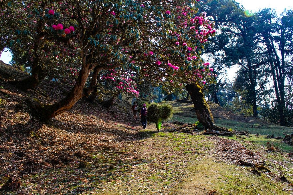
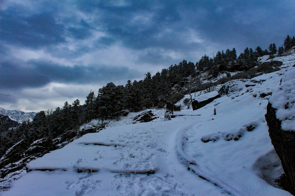
So this was my experience of the Deoriatal Chandrashila trek. I have done this trek more than 7 times and every time I had a wonderful experience. During summers, the meadows and trail all look green and you could actually walk into the clouds. If you are looking for the green experience the April, May and June are the months. To get the perfect view of the peaks, autumn season is the best. During this season, one can get a lucid view of all the peaks and also a clear sunset and sunrise. If you are going to admire the snow-capped peaks then October, November and December are the months. During winters, the trail gets covered with a white blanket of snow. It can be your perfect winter trek. January, February and March are the months if you want to experience the snow trek. Avoid trekking in the monsoon season as the roads are prone to landslides and the trail also gets slippery and filled with leeches.
Will be posting a blog about a Guide to Deoriatal Chandrashila Trek which will help you doing the trek on your own in a cheapest way.
Stay Tuned 🙂